AtlasLog in

The world, taken apart.

Learn each unit with in-depth visuals and explanations

AP World History: Modern

9 chapters
No. 018 pages

The global tapestry

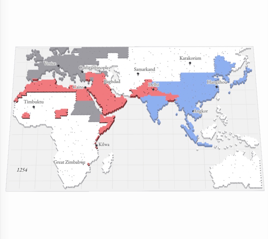
c. 1200–1450 Afro-Eurasia in the mid-1200s as a paper-relief hex map colored by the faith of its rulers: red Muslim lands from Morocco to Delhi, blue Buddhist, Hindu and Confucian Asia, gray Christian Europe and Ethiopia, and a white gap where the Mongols ruled Iran and Central Asia
No. 028 pages

Networks of exchange

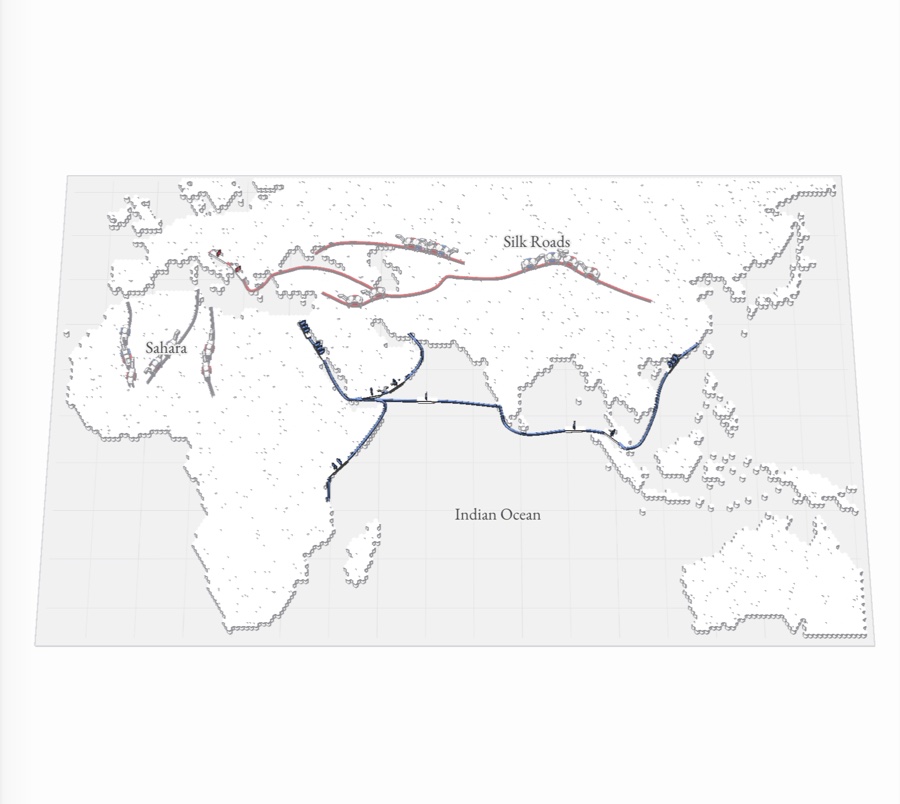
c. 1200–1450 A paper-relief map of Africa, Europe and Asia with the Silk Roads in red, the Indian Ocean sea lanes in blue and the trans-Saharan caravan routes in gray, camels and ships moving along them
No. 035 pages

Land-based empires

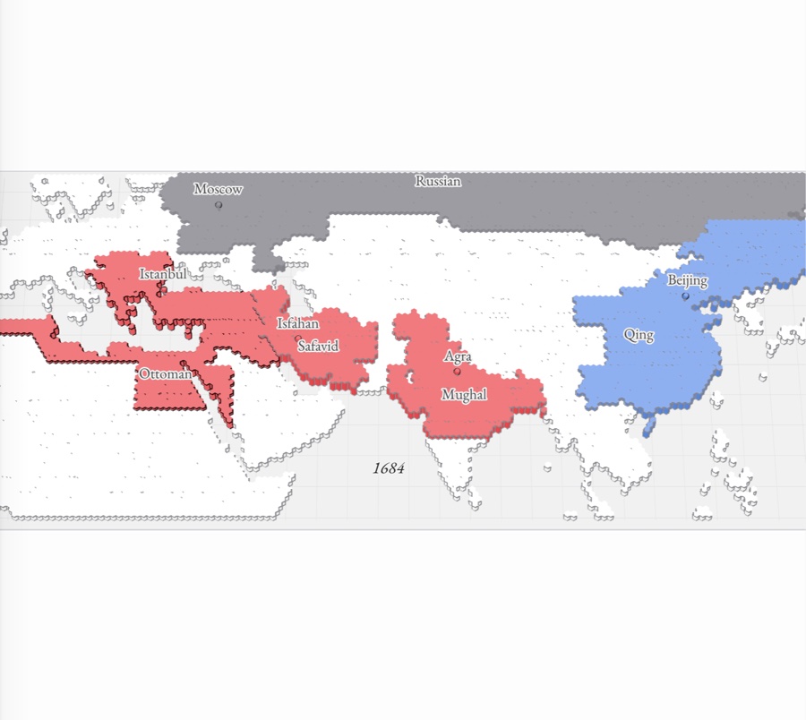
c. 1450–1750 The Ottoman, Safavid and Mughal empires in red, the Qing in blue and Russia in gray across a paper-relief map of Afro-Eurasia around 1684, with pins at Istanbul, Isfahan, Agra, Beijing and Moscow
No. 049 pages

Transoceanic interconnections

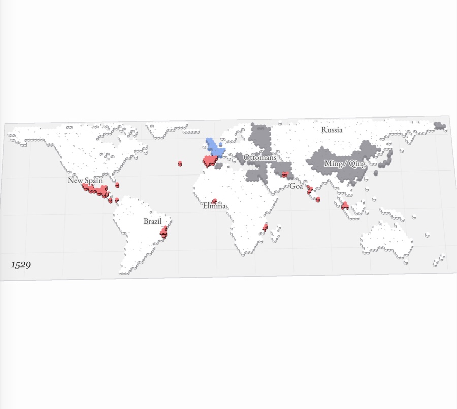
c. 1450–1750 A world map in paper relief, about 1530: Spain and Portugal’s American conquests and Indian Ocean ports in red, the Ottoman and Ming empires in gray, northwestern Europe in blue
No. 0511 pages

Revolutions

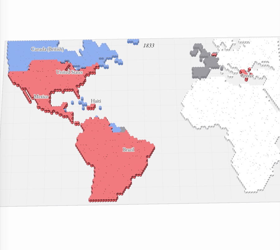
c. 1750–1900 A paper-relief map of the Atlantic world in 1833: the United States, Mexico, Haiti, Brazil and Spanish South America raised in red as independent nations, Canada and the Guianas still blue colonies, and Britain, France, Spain and Portugal in gray, with Greece newly red
No. 069 pages

Consequences of industrialization

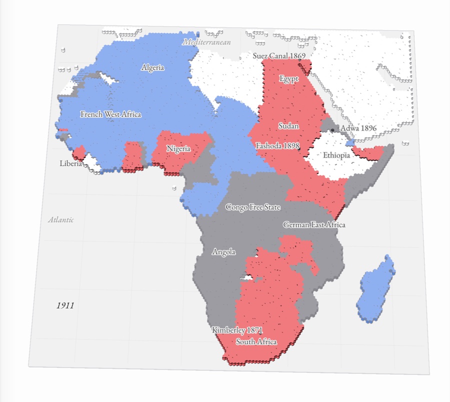
c. 1750–1900 Africa in 1911 as paper relief: British colonies red from Egypt to the Cape, French blue across the north and west, the other powers gray, with Ethiopia and Liberia still independent
No. 0710 pages

Global conflict

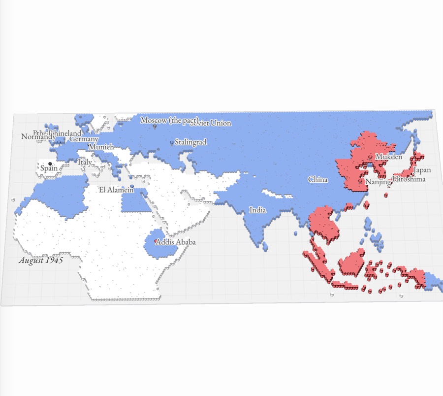
c. 1900–present A map of Europe, Africa and Asia in August 1945: the last Axis-held lands in red across Japan, Korea, eastern China and Southeast Asia, Allied territory in blue, with pins at Munich, Stalingrad, El Alamein, Normandy and Hiroshima
No. 0810 pages

Cold War and decolonization

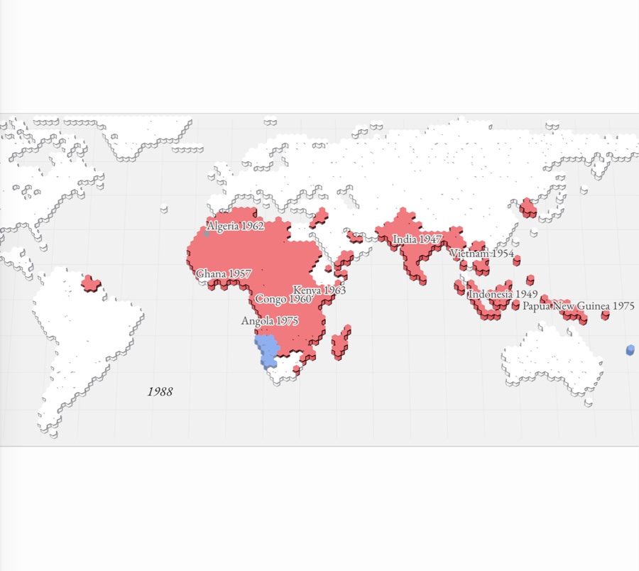
c. 1900–present A paper-relief world map in 1988: nearly all of Africa, South Asia and Southeast Asia raised in red as independent states, each labeled with its year (India 1947, Indonesia 1949, Ghana 1957, Algeria 1962, Angola 1975), with Namibia still in blue as the last colony
No. 0910 pages

Globalization

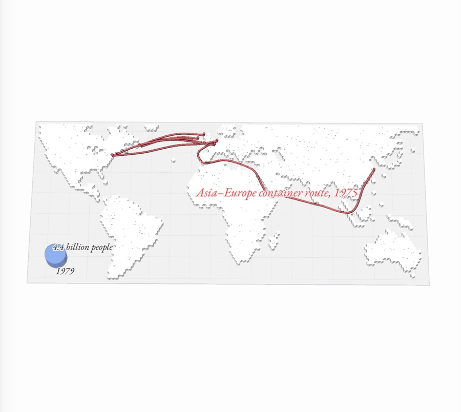
c. 1900–present A paper-relief world map with red routes joining the continents: the transatlantic links of radio, flight, cable and jets, and the container route from East Asia to Europe through Suez, and a blue disc for the world’s billions of people